- Home
- About
-
Programs & Services
- Ag Stewardship/INfield Advantage >
- Drainage
- Financial Assistance/Cost Share Programs >
- Invasive Species >
- Map Resources
- Native Plant Sale
- Native Tree Sale
- Rain Barrel Info & Sales
- Rule 5 Submission
- Soil Is Alive: Soil Health Trailer
- Soil Maps & Surveys
- Soil Testing
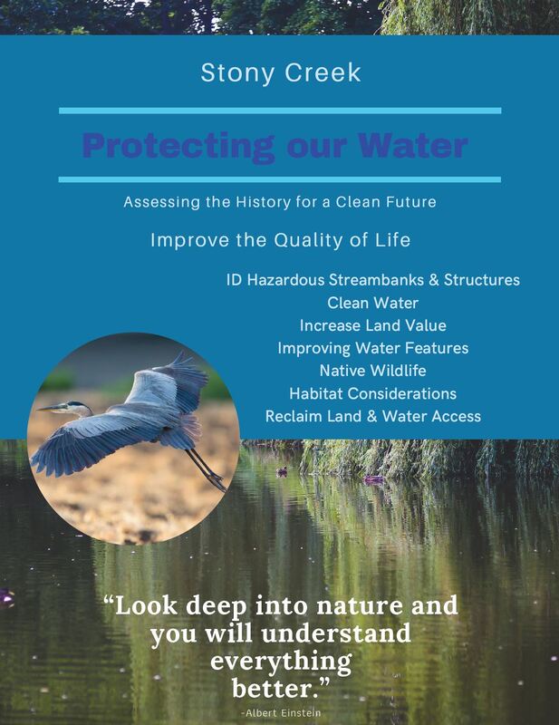
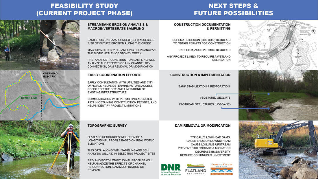
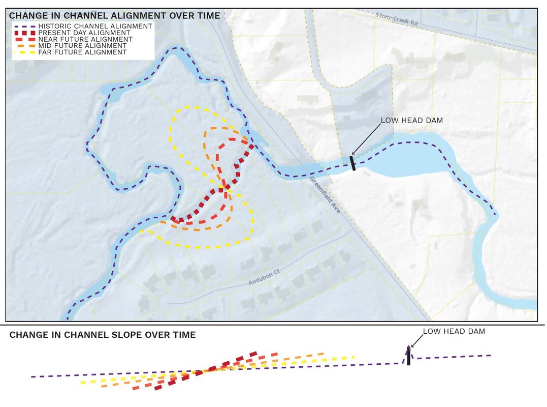
- Stony Creek Feasibility Study
- Photo Contest
- Well Capping
- Well Water Testing
- Report a Polluter
- Tool Loan Program
- Video Resources
- Urban Conservation
- Events
- Online Store
- Home
- About
-
Programs & Services
- Ag Stewardship/INfield Advantage >
- Drainage
- Financial Assistance/Cost Share Programs >
- Invasive Species >
- Map Resources
- Native Plant Sale
- Native Tree Sale
- Rain Barrel Info & Sales
- Rule 5 Submission
- Soil Is Alive: Soil Health Trailer
- Soil Maps & Surveys
- Soil Testing
- Stony Creek Feasibility Study
- Photo Contest
- Well Capping
- Well Water Testing
- Report a Polluter
- Tool Loan Program
- Video Resources
- Urban Conservation
- Events
- Online Store